

Winter battles again with spring, as temperatures go up and down like a roller coaster.
Environment Canada has issued a special winter weather alert for Chatham-Kent and much of Southwestern Ontario.
The low pressure system that has brought heavy rain to some and twenty degree temperatures to others will bring winter-like weather to most before it exits the province Tuesday afternoon.
It will be a very warm day for some regions today, particularly over Eastern Ontario where temperatures may soar into the mid twenties, with readings near 20 again from near London to the Greater Toronto area.
However, a big change is coming as winter clashes again with spring. Showers, accompanied by occasional wind gusts up to 85 km/h, are moving in from Southwestern Ontario. This will herald an end to the first taste of almost summerlike weather across the regions. The showers will move into Eastern Ontario later this afternoon.
A very sharp Arctic cold front will sweep across Southern Ontario this afternoon then move into Eastern Ontario this evening. Temperatures will plunge quite dramatically as a result, with values dropping to near freezing or a bit below from roughly the Toronto area and west by Tuesday morning.
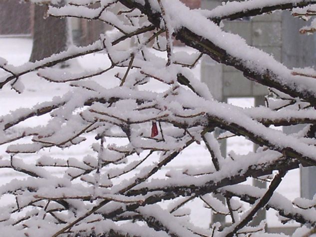
As a result, showers will begin to change over to a few centimetres of snow from near Georgian Bay to Lake St Clair tonight with the transition zone reaching Eastern Ontario later Tuesday morning.
During this transition, there is a risk of a few hours of freezing rain or ice pellets.
In addition, after the changeover to snow, a few centimetres are likely by the time the snow tapers off later on Tuesday. There will be enough snow to whiten the ground in many areas. Temperatures will be sharply colder on Tuesday with afternoon values expected to be near or below freezing as winter pushes spring well to the southeast of the regions.
Motorists should be prepared for a quick return to winter driving conditions, especially in areas that receive a period of heavier snow. Untreated roads and surfaces may quickly become partially to mostly snow covered and slippery.
Latest indications show winter’s Victory will be short-lived, as temperatures will moderate back up closer to normal by the end of the week.