
The St. Clair Region Conservation Authority (SCRCA) has issued a flood watch, as rain continues to hammer the region.
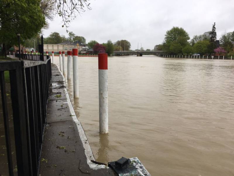
SCRCA officials say water levels in the Sydenham River have been climbing quickly over the past 12 hours and have resulted in over-bank flooding into floodplain areas, with over 40 mm of precipitation being received across the area over the past 24 hours.
“Watercourses are experiencing near-bankfull conditions as rain continues to drain through the watershed,” SCRCA officials stated.
“Localized flooding has continued to expand into low lying areas overnight, mostly into agricultural, parkland and floodplain areas. Water levels in all areas of the watershed are expected to remain high with swift flowing water throughout the weekend. Precipitation forecast calls for additional precipitation of 30-40 mm today and tomorrow. This will result in increased flood risk and additional road closures. Rural drains and watercourses will remain full as a result of saturated field conditions and floodplain areas will continue to be impacted.”
Roads impacted by high water levels include:
– Pretty Road near Stanley Road
– Waubuno Road north of Bickford Line
– Black Ash Road south of Petrolia Line
– Plowing Match Road between Rokeby Line and Petrolia Line
– Fairweather Road between Rokeby Line and Shiloh Line
“Additional roads may be impacted today and tomorrow as flows peak in many areas of the watershed,” SCRCA officials stated.
“Municipal emergency response staff and road superintendents should review emergency response plans and monitor local conditions closely. Residents are reminded to avoid watercourses and flooded areas due to saturated and slippery banks as well as the danger of swift moving water.”
SCRCA officials sayd they will monitor the flood condition of the watersheds in the region and will provide warnings to municipal officials and media in the event conditions develop which could result in the potential of more severe flooding.
This message will remain in effect until Monday May 6th, unless otherwise updated.
A rainfall warning issued by Environment Canada remains in effect.
The St. Clair Region Conservation Authority is located in southwestern Ontario and includes the Sydenham River watershed and smaller watersheds draining directly into southern Lake Huron, the St. Clair River and northeastern Lake St. Clair.
– Photo credit: Aaron Hall