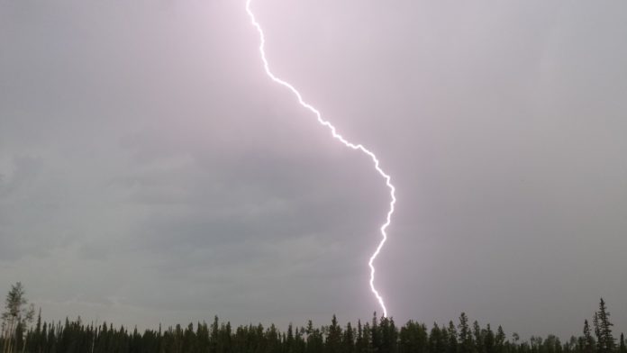
The severe thunderstorm warning ended at 10:54 p.m. and the watch ended at 12:08 p.m.
Severe thunderstorm warning
At 9:26 p.m. EDT, Environment Canada meteorologists are tracking a line of severe thunderstorms capable of producing very strong wind gusts, up to nickel size hail and heavy rain.
This line of severe thunderstorms is located from Wellburn to Leamington, moving east at 60 km/h.
Hazard: 90 km/h wind gusts and nickel size hail and locally heavy rainfall.
Locations impacted include:
London, St. Thomas, Woodstock, Rodney, Aylmer, Ingersoll, Tillsonburg, Norwich, Delhi, Wheatley Provincial Park, Blenheim, Rondeau Provincial Park, Ridgetown, Melbourne, Mount Brydges, John E. Pearce Provincial Park, Komoka, Komoka Provincial Park, Shedden and Port Stanley.
Take cover immediately, if threatening weather approaches. Heavy downpours can cause flash floods and water pooling on roads. Large hail can damage property and cause injury. Strong wind gusts can toss loose objects, damage weak buildings, break branches off trees and overturn large vehicles. Lightning kills and injures Canadians every year. Remember, when thunder roars, go indoors!
The Office of the Fire Marshal and Emergency Management recommends that you take cover immediately if threatening weather approaches.
Please continue to monitor alerts and forecasts issued by Environment Canada. To report severe weather, send an email to ONstorm@canada.ca or tweet reports using #ONStorm.
Severe thunderstorm warning
At 8:56 p.m. EDT, Environment Canada meteorologists are tracking a line of severe thunderstorms capable of producing very strong wind gusts, up to nickel size hail and heavy rain.
This line of severe thunderstorms is located from Argyle to Altona, moving east at 50 km/h.
Hazard: 90 km/h wind gusts and nickel size hail and locally heavy rainfall.
Locations impacted include:
Oshawa, Lindsay, Peterborough, Cobourg, Port Perry, Whitby, Bowmanville, Port Hope, Mount Zion, Brooklin, Scugog, Janetville, Orono, Newcastle, Omemee, Emily Provincial Park, Bridgenorth, Lakefield, Mark S. Burnham Provincial Park and Serpent Mounds Provincial Park.
Take cover immediately, if threatening weather approaches. Heavy downpours can cause flash floods and water pooling on roads. Large hail can damage property and cause injury. Strong wind gusts can toss loose objects, damage weak buildings, break branches off trees and overturn large vehicles. Lightning kills and injures Canadians every year. Remember, when thunder roars, go indoors!
The Office of the Fire Marshal and Emergency Management recommends that you take cover immediately if threatening weather approaches.
Please continue to monitor alerts and forecasts issued by Environment Canada. To report severe weather, send an email to ONstorm@canada.ca or tweet reports using #ONStorm.
For more information: http://www.emergencymanagementontario.ca/english/beprepared/beprepared.html.
Severe thunderstorm warning
This line of severe thunderstorms is located from 20 kilometres northwest of Ipperwash Beach to 35 kilometres west of Amherstburg, moving east at 65 km/h.
Hazard: 90 km/h wind gusts and nickel size hail and locally heavy rainfall of 50 mm within 1 hour.
Locations impacted include:
Windsor, Leamington, Sarnia, Chatham, Amherstburg, Petrolia, Forest, Grand Bend, Tecumseh, Kingsville, Belle River, Lakeshore, Wheatley Provincial Park, Tilbury, Wallaceburg, Oil Springs, Blenheim, Watford, Lambton Shores and The Pinery Provincial Park.
Take cover immediately, if threatening weather approaches. Heavy downpours can cause flash floods and water pooling on roads. Large hail can damage property and cause injury. Strong wind gusts can toss loose objects, damage weak buildings, break branches off trees and overturn large vehicles. Lightning kills and injures Canadians every year. Remember, when thunder roars, go indoors!
Severe thunderstorm warnings are issued when imminent or occurring thunderstorms are likely to produce or are producing one or more of the following: large hail, damaging winds, torrential rainfall.
The Office of the Fire Marshal and Emergency Management recommends that you take cover immediately if threatening weather approaches.
Please continue to monitor alerts and forecasts issued by Environment Canada. To report severe weather, send an email to ONstorm@canada.ca or tweet reports using #ONStorm.
For more information: http://www.emergencymanagementontario.ca/english/beprepared/beprepared.html.
Severe thunderstorm warning issued at 7:06 p.m.
At 7PM EDT, Environment Canada meteorologists are tracking a line of severe thunderstorms over west of Detroit, and is moving southeastward at 60 km/h.
Hazards: strong wind gusts up to 90 km/h, up to nickel size hail and heavy rainfalll of 50 mm within an hour. Frequent lightning.
Locations impacted include:
Chatham, Petrolia, Forest, Tecumseh, Belle River, Lakeshore, Tilbury, Wallaceburg, Oil Springs, Ridgetown, McGregor, Windsor Airport, Maidstone, Essex, Cottam, Stoney Point, Comber, Walpole Island, Port Lambton and Lighthouse Cove.
Heavy downpours can cause flash floods and water pooling on roads. Strong wind gusts can toss loose objects, damage weak buildings, break branches off trees and overturn large vehicles. Lightning kills and injures Canadians every year. Remember, when thunder roars, go indoors!
Severe thunderstorm warnings are issued when imminent or occurring thunderstorms are likely to produce or are producing one or more of the following: large hail, damaging winds, torrential rainfall.
The Office of the Fire Marshal and Emergency Management recommends that you take cover immediately if threatening weather approaches.
Please continue to monitor alerts and forecasts issued by Environment Canada. To report severe weather, send an email to ONstorm@canada.ca or tweet reports using #ONStorm.
For more information: http://www.emergencymanagementontario.ca/english/beprepared/beprepared.html.
Severe thunderstorm watch issued at 2:06 p.m.
Conditions are favourable for the development of severe thunderstorms this afternoon into this evening.
Some of these thunderstorms may be capable of producing strong wind gusts up to 90 km/h, large hail up to 2 cm and heavy rain up to 50 mm within one hour.
Lightning kills and injures Canadians every year. Remember, when thunder roars, go indoors!
Severe thunderstorm watches are issued when atmospheric conditions are favourable for the development of thunderstorms that could produce one or more of the following: large hail, damaging winds, torrential rainfall.
The Office of the Fire Marshal and Emergency Management recommends that you take cover immediately if threatening weather approaches.
Please continue to monitor alerts and forecasts issued by Environment Canada. To report severe weather, send an email to ONstorm@canada.ca or tweet reports using #ONStorm.
For more information: http://www.emergencymanagementontario.ca/english/beprepared/beprepared.html.
Follow:ATOM feedATOM
This story will be updated.


