
A storm hunter for The Weather Network believes “there is a slight danger of tornadoes” in the Chatham-Kent area this evening.
Mark Robinson says Chatham-Kent is in a danger area for severe thunderstorms.
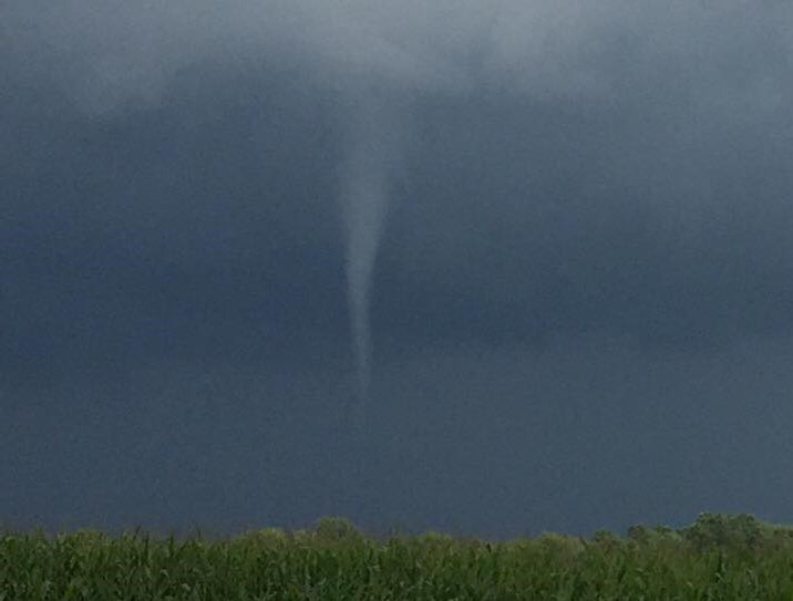
Windsor, Essex county, Chatham, you are in a danger area for severe t-storms tonight. There is a slight danger of tornadoes. #onstorm pic.twitter.com/sC3CHz4YwT
— Mark Robinson (@StormhunterTWN) 24 February 2017
Robinson said the main threat this evening in Southwestern Ontario is wind.
“These will be fast moving storms and likely arrival is after sunset. Be prepared!” Robinson tweeted.
Environment Canada forecasters say there is a risk of a thunderstorm tonight along with showers.
Officials with Environment Canada told Blackburn News that there is a very slight chance of a tornado developing over Southwestern Ontario, but the probability is low.
National Weather Service officials in Michigan say isolated tornadoes are possible tonight in the Detroit area, along with hail 1″ in diameter and damaging wind gusts up to 70 mph or 113 km/h.
The strongest storms are expected between 6 p.m. and 12 p.m. tonight, the Michigan forecasters said.
No weather statements or warnings have been posted as of yet North of the border.
We’ll provide more information as it becomes available.