
The Lower Thames Valley Conservation Authority (LTVCA) has issued a flood outlook for all watercourses and the Lake Erie shoreline.
“A special weather statement has been issued by Environment Canada. Rainfall is expected to begin before noon and last until the overnight period. Rainfall totals are predicted to be in the 15 to 30 mm range,” LTVCA officials said in a media release.
“A Gale Warning for Lake Erie has also been issued by Environment Canada. Winds are expected to pick up this evening with sustained winds above 35 km/hr from the southwest and west lasting throughout the overnight period. Peak winds are predicted around midnight with sustained wind speeds from the southwest of around 60 km/hr and gusts of up to 85 km/hr. Waves on Lake Erie are forecasted to reach 2 m in height.”
The large amount of rain predicted could lead to localized flooding in areas of poor drainage, LTVCA officials say.
“Local watercourses will rise over the next 18 to 24 hours and, should the larger amounts of rainfall appear, some could spill their banks and flood low lying adjacent areas. Depending on how much rain falls, the LTVCA may need to operate the Indian-McGregor Creek Diversion Channel in order to protect the south end of the City of Chatham,” LTVCA officials say.
“Strong winds this evening and overnight will be driving waves onshore along most of the Lake Erie shoreline in Chatham-Kent and Elgin County. There is a risk that wave action could damage shoreline protection works and cause shoreline erosion. Flood prone areas such as Erie Shore Drive in Chatham-Kent could be expected to see some flooding due to wave crashing against shoreline protection works and spraying water up onto the land. Over the past few years, this type of flooding has occurred when sustained winds from the south (southwest to southeast) exceed 35 km/hr, and peak winds are predicted to be well above that threshold. Residents along the Lake Erie shoreline should pay attention to local conditions and prepare accordingly.”
The Thames River is flowing higher than usual due to rain late last week,
“The additional rainfall will cause it to rise further,” LTVCA officials say.
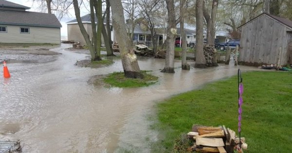
“Should the higher rainfall amounts appear, there could be some flooding in the most low lying areas adjacent to the river, such as the sidewalk in downtown Chatham, later tomorrow and into Wednesday. People should take extra caution and avoid the river, ditches, streams and shorelines. On our local watercourses, the combination of slippery banks and fast moving water can be dangerous. Along the shoreline, waves can be strong and the shoreline slippery. There could also be hazardous debris within the waves and water which could be thrown up onto the shoreline. Standing water can also present its own unseen hazards. Children and animals should be kept away from the water.”
LTVCA officials will continue to monitor the situation and update this advisory if necessary.