A special weather statement remains in effect for Chatham-Kent and Sarnia-Lambton
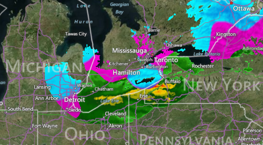
A moisture laden low pressure area located over Kentucky this morning will bring a cold rain and a wintery mix of precipitation to the region as it tracks up just south of Lakes Erie and Ontario later today and tonight then to southeastern Quebec Thursday.
Precipitation will arrive this morning in the form of rain or a rain and wet snow mix.
There may be a brief risk of freezing rain in the morning as well.
Rain and brisk easterly winds will continue throughout the day into tonight, with total rainfall amounts of 20 to 25 mm likely.
The rain is then expected to change over to snow later tonight as cold air gets pumped in from the north in the wake of this moisture laden low pressure area.
A few centimetres of snow is possible by Thursday night.
Environment Canada continues to monitor this system very closely.
Rainfall warnings, similar to rainfall warnings in effect for areas further east, may also be required.
Poor travelling conditions are expected, along with a return to winter driving conditions Thursday after the precipitation turns over to snow.
Please continue to monitor alerts and forecasts issued by Environment Canada.
– Photo credit: www.accuweather.com