
Morning Coffee – By Aaron Hall

Flood watch remains in tact
There are no new updates from the St. Clair Region Conservation Authority (SCRCA) as a flood watch remains in effect and the Darcy McKeough Floodway remains on standby.
SCRCA officials said on Saturday that the slow movement of several low pressure systems earlier this week resulted in 50-70 millimeters of rainfall across most of the watershed.
“Water levels continue to remain extremely high resulting in over-bank flooding into floodplain areas,” SCRCA officials say.
Water levels were expected to peak sometime on Sunday in the east Sydenham River at Dresden and peak in Bear Creek at Brigden by late Saturday.
SCRCA officials say several roads have been impacted by the high water levels. These roads include:
St. Clair Township:
– Pretty Road near Stanley Road
Enniskillen Township:
– Plowing Match Road
– Fairweather Road
SCRCA officials say water levels in the lower areas were anticipated to begin falling on Sunday with no additional precipitation expected.
“The W. Darcy McKeough Floodway is on operational standby and may be activated to reduce any potential residential flooding in Wallaceburg should the operating conditions be reached,” SCRCA officials say.
Watch for more information as it becomes available.
Flood watch remains in effect for the Thames River
The Lower Thames watershed received between 45 and 60 mm of rainfall since Wednesday, Lower Thames Valley COnservation Authority officials said on the weekend.
Water levels on local watercourses peaked overnight on Friday and were dropping.
However, many are still running high with some having spilled out into adjacent low lying areas.
Indian and McGregor Creeks in Chatham-Kent have exceeded levels typically seen for spring type events over the last few years.
The Lower Thames Valley Conservation Authority was operating the Indian-McGregor Creek Diversion Channel to protect the south end of the City of Chatham from flooding.
All along the Thames from Delaware to Chatham, the low lying river flats are flooded.
Water levels can still be expected to rise upstream of Chatham as water from the Upper Thames makes its way downstream. Water levels on the Thames are not expected to cause flooding outside the low lying, dominantly agricultural, river flats.
In Chatham, the downtown sidewalk along the river and the access road under the 5th Street bridge are under water and should be expected to remain so into the middle of next week. The Lower Thames Valley Conservation Authority no longer expects to have to operate the 6th Street Backwater Dam and Pumping Station in downtown Chatham. The Thames River should be expected remain high into the middle of next week.
Lake St. Clair water levels are currently 10-15 cm under their record high levels. Strong winds out of the northwest were predicted throughout the weekend with speeds reaching 30 km/hr gusting to 45 km/hr. Officials say there was a risk that, in vulnerable areas, wave action could cause flooding, damage shoreline protection works and cause shoreline erosion along those areas of the Lake St. Clair shoreline within the jurisdiction of the LTVCA, such as the Lighthouse Cove area and the shoreline of Dover Township.
If you have a suggestion, story idea, column idea, or if you want to say hello… drop me an e-mail at aaron@sydenhamcurrent.ca.
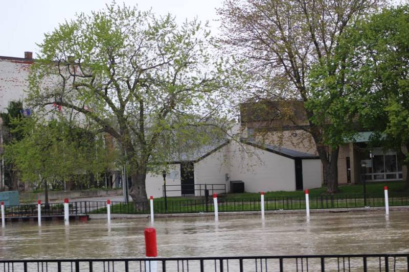
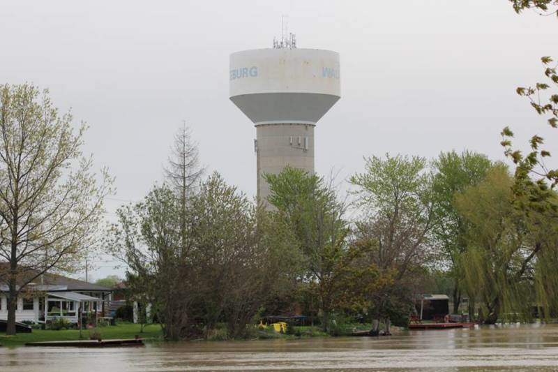
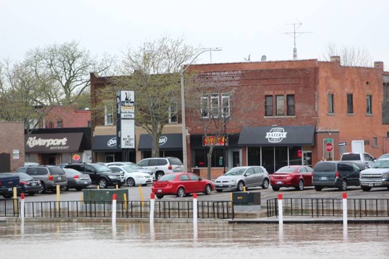
Photos of the day
In case you didn’t notice, the Sydenham River is really high in downtown Wallaceburg. Thanks to Kristin and Karel for sending in these photos:
Photos by Kristin Verleyen:
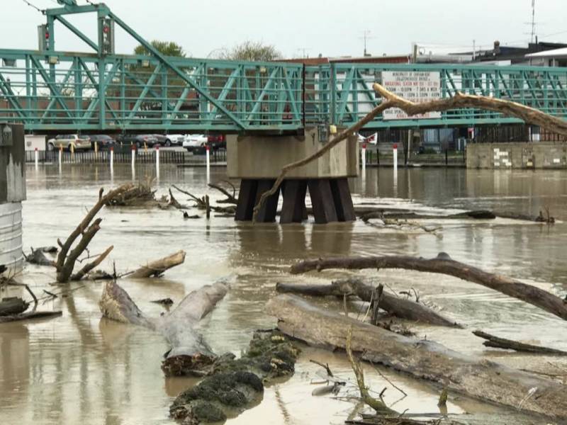


Photos by Karel Vitamvas:
Weather forecast for Monday, May 8, 2017
A frost advisory remains in effect for Chatham-Kent.
Frost may damage some crops in frost-prone areas.
Temperatures early this morning have dropped to near the freezing mark across many areas.
Temperatures will quickly rise above the freezing mark after sunrise. However, temperatures are expected to fall to near the freezing mark once again tonight and early Tuesday morning. Frost is possible in some areas.
Take preventative measures to protect frost-sensitive plants and trees.
Frost advisories are issued when temperatures are expected to reach the freezing mark during the growing season, leading to potential damage and destruction to plants and crops.
Today – Sunny. Wind becoming northwest 20 km/h gusting to 40 this afternoon. High 13. UV index 6 or high.
Tonight – Clear. Wind northwest 20 km/h gusting to 40 becoming light this evening. Low minus 1 with patchy frost.
World news
Quebec braces for more flooding
Emmanuel Macron wins French presidential race
World leaders congratulate Emmanuel Macron on his win
North Korea detains a fourth American, state media says
Up to 80 Chibok girls have been released by Boko Haram
Puerto Rico to close nearly 200 public schools amid debt crisis