
The St. Clair Region Conservation Authority (SCRCA) issued a watershed conditions statement on Thursday, as water levels are rising across the region.
SCRCA officials say the region had 40 to 70 mm of precipitation fall over a 48 hour span and an additional 15 mm was forecast for Thursday night and Friday morning.
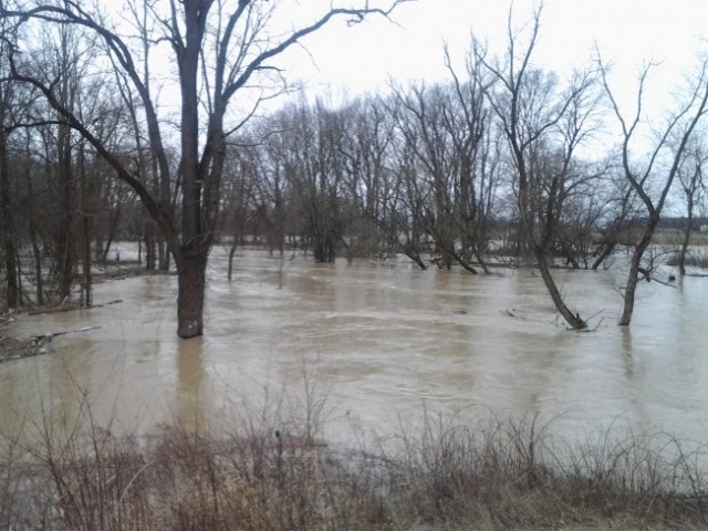
“Water levels on the Sydenham River and its tributaries continue to rise moderately as a result of precipitation received over the last two days,” SCRCA officials say.
“Many rural areas including fields and floodplains have become saturated resulting in more immediate run off into rivers and streams. Water levels on the Sydenham River and its tributaries will remain high and near top of the bank on Sydenham River for the next few days.”
Communities to the north of Petrolia and west of Alvinston has received the highest rainfall totals,” SCRCA officials say.
“These areas (Petrolia, Brigden and Oil springs) are experiencing localized flooding. Farm fields throughout the region can be expected to continue for the next few days. Flooding is anticipated to be minor in nature with no additional precipitation is in the forecast.”
Waterworks Road is closed between Courtright Line and Moore Line due to flooding, SCRCA officials say.
“Municipal emergency response staff and road superintendents should monitor local conditions closely. Residents are reminded to avoid watercourses and flooded areas due to saturated and slippery banks as well as the danger of swift moving water.”
The St. Clair Region Conservation Authority will monitor the flood condition of the watersheds in the region and will provide warnings to municipal officials and media in the event conditions develop which could result in the potential of flooding.
SCRCA officials say this message will remain in effect until Saturday, November 3, 2018 unless otherwise updated.