
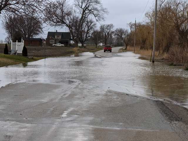
The St. Clair Region Conservation Authority has issued a flood outlook, as upwards of 25 mm of precipitation is expected over the next 48 hours, along with winds gusts up to 55 km/h and the possibility of minor flooding.
SCRCA officials say a low pressure system making its way to southern Ontario is anticipated to bring approximately 15 to 20 mm of rain starting Tuesday evening and continuing through Wednesday, with an additional 5 mm Thursday.
“Water levels may elevate into natural floodplain areas, parks and farm fields,” SCRCA officials stated.
“Soils may become saturated from the rain and could contribute to ponding, increased runoff into watercourses, and possible increased erosion and seepage issues.”
Southerly winds beginning Tuesday are forecasted to become southeasterly Tuesday evening, increasing in speed early Wednesday and continuing through the day before subsiding early Thursday, SCRCA officials added.
“Wind gusts are anticipated to be upwards of 55 km/h,” officials say.
“Winds from a southerly direction have the potential to cause a backwater effect in the Wallaceburg area, further slowing the movement of water out of the river and contributing to elevated water levels.”
SCRCA officials added: “River banks are expected to be slippery, with possible minor erosion. Residents are reminded to avoid watercourses and flooded areas due to slippery banks and cold, swift moving water. Children and pets should be kept away from the water.”
The Conservation Authority continues to monitor watershed conditions and will issue advisories to municipalities and media should flood issues arise, SRCA officials say.
Municipal emergency response staff and road superintendents should monitor local conditions closely.
This flood outlook will remain in effect until Thursday, April 30, 2020, unless otherwise updated.